Concrete scanning is one type of ground penetrating radar ( GPR ) survey. It is part of a larger discipline known as GPR studies or GPR investigations. Furthermore, GPR instruments are part of the larger world of geophysics.
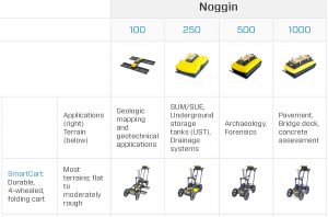
ConcreteScanner.com focuses on equipment built by Sensors & Software of Canada. While their primary concrete scanner has a frequency of 1000 MHz, their product line offers 12.5, 25, 50, 100, 200, 250, 500, and 1000 MHz antennas. Most of these antenna frequencies are part of their Noggin and pulseEKKO PRO systems, which allows post processing with EKKO_Project Software and EKKO_Mapper software.
Noggin Instruments
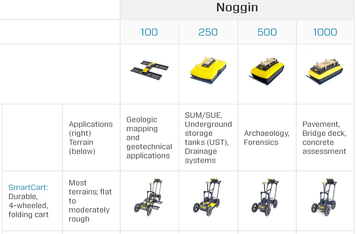
Noggin Antenna and Transducer Selection
pulseEKKO Instruments
pulseEKKO Antenna and Transducer Selection
A wide range of antennas allow for a range of applications. In addition to investigating concrete, GPR services include utility and private facility locating, mining, military, environmental studies, ice and snow studies, forensic science, archaeology, roads, and pavement.
Size and Scale of GPR Surveys
Small Scale GPR Investigations
Smaller scale sites that cover hundreds of feet, often acquire data along a grid pattern, like concrete scanning. This technique of collecting data allows the results to be presented as three-dimensional images. The technique of plotting the results in plan view as a function of depth is a very powerful tool.
Large-scale GPR Investigations
Large-scale surveys often include conditions pertaining to changes in geology, soils, snow and ice conditions, and mapping utilities and facilities over a great distance. These surveys may not lend themselves to three-dimensional representations. It is difficult to collect enough data for large-scale projects to generate three-dimensional plots. Nonetheless, the cross-section type results are often more than sufficient to provide an interpretation of how conditions vary at depth.
Applications for GPR
Utility and Private Facility Locating
This area of GPR investigations, in theory, is straightforward. For this purpose, one is attempting to locate a buried line, cable, pipe, or waste line. As in concrete scanning, objects made of solid metal make some of the best targets to locate. Unless they are near the surface, plastic, concrete, and other nonmetallic objects can be a challenge to locate, especially with poor soil conditions.
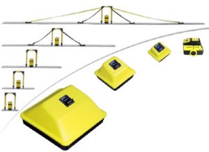
Mining
GPR investigations in the mining industry cover a wide range of potential issues. Studies often include mapping faults, fractures, joints, rock conditions, water, variations in soils, structural conditions. While high-resolution antennas, like the 500 or 1000 MHz antennas, image solid rock, investigations along the ground surface often require lower frequency antennas, like the 50, 100, 200, and 250 MHz antennas.
GPR Survey for Faults and Joints
Military and Forensic Science
Since GPR methods are able to detect metal, unexploded ordnances, bombs, guns, knives, and bullets are easy to detect, with good site conditions. It is fairly common to look for buried persons, drugs, and other large scale objects.
Environmental Studies
In areas with soils that have minimum clay content, environmental professionals, engineers, and geologists are commonly investigating for metal from old 55-gallon drums, fuel oil tanks, and leaky pipes. Soil and water contamination are also a concern. These types of surveys often require a fair amount of experience to interpret the results.
Ice and Snow
Snow and ice allow a GPR signal to pass through with little attenuation, much like air. This media great for subsurface studies. The studies include characterizing snow and ice thickness, as well as, locating people and buried objects. Ice research using GPR is very important. It assists with identifying changes global weather and movement of glaciers.
Archaeology
Finally, we get to archaeology. This category, like forensic studies, is very challenging. Problems arise with the fact that one needs to map some very subtle variations. These variations may reflect naturally occurring changes at depth. The greater the desire not to miss a feature can lead to numerous false positives. However, the pay off in locating a spectacular find may be well worth the effort.
GPR Survey for Graves
Be Informed
As with concrete scanning, be aware, it is not always clear where, when, and how GPR will produce the best results. Factoring in issues pertaining to the field conditions associated with a target of concern, may mean GPR is not going to produce desirable results. Sometimes a site needs to be geophysically investigated using other geophysical methods. Click here for information about engineering geophysics.
Cookies To make this site work properly, we sometimes place small data files called cookies on your device. Most big websites do this too.
Accept
Cookies Settings
Cookie Box Settings
Cookie Box Settings
Privacy settings
Decide which cookies you want to allow.
You can change these settings at any time. However, this can result in some functions no longer being available. For information on deleting the cookies, please consult your browser’s help function.
Learn more about the cookies we use.
With the slider, you can enable or disable different types of cookies:
This website will
This website won\'t
Essential: Remember your cookie permission setting
Essential: Allow session cookies
Essential: Gather information you input into a contact forms, newsletter and other forms across all pages
Essential: Keep track of what you input in a shopping cart
Essential: Authenticate that you are logged into your user account
Essential: Remember language version you selected
Functionality: Remember social media settings
Functionality: Remember selected region and country
Analytics: Keep track of your visited pages and interaction taken
Analytics: Keep track about your location and region based on your IP number
Analytics: Keep track of the time spent on each page
Analytics: Increase the data quality of the statistics functions
Advertising: Tailor information and advertising to your interests based on e.g. the content you have visited before. (Currently we do not use targeting or targeting cookies.
Advertising: Gather personally identifiable information such as name and location
Remember your login details
Essential: Remember your cookie permission setting
Essential: Allow session cookies
Essential: Gather information you input into a contact forms, newsletter and other forms across all pages
Essential: Keep track of what you input in a shopping cart
Essential: Authenticate that you are logged into your user account
Essential: Remember language version you selected
Functionality: Remember social media settings
Functionality: Remember selected region and country
Analytics: Keep track of your visited pages and interaction taken
Analytics: Keep track about your location and region based on your IP number
Analytics: Keep track of the time spent on each page
Analytics: Increase the data quality of the statistics functions
Advertising: Tailor information and advertising to your interests based on e.g. the content you have visited before. (Currently we do not use targeting or targeting cookies.
Advertising: Gather personally identifiable information such as name and location